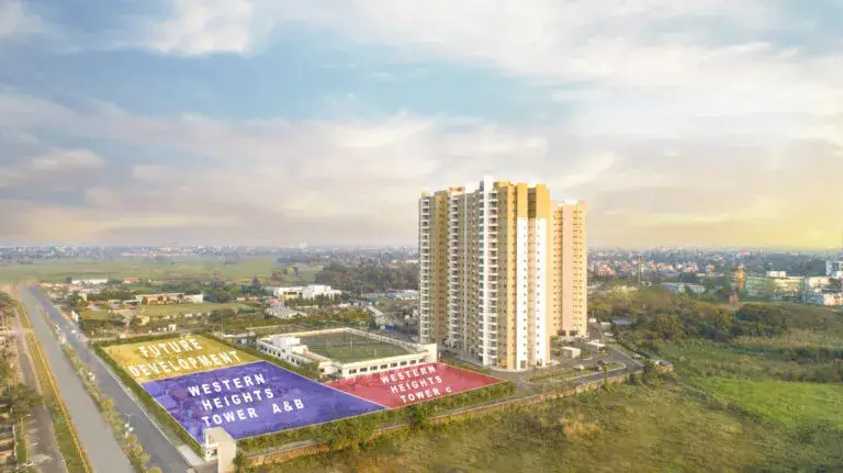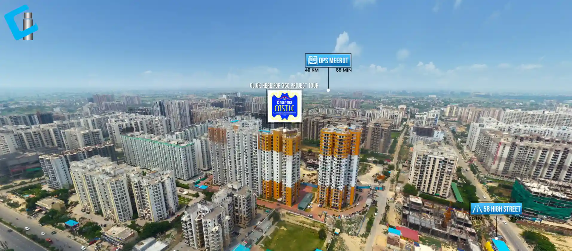
Real estate developers utilize 360° aerial videos to understand a property’s connectivity, surrounding infrastructure, and the overall development area. We at NS Ventures use creative drone technologies along with video editing and post production to provide our clients with aerial video content for their real estate projects.
Aerial videos help potential buyers understand a project’s location and what is around the project.
What Is a 360° Aerial Video?
360° aerial videos provide potential buyers with an elevated perspective of a property and what is around it through an immersive aerial perspective presentation. This perspective captures building and infrastructure, as well as, developments, roads, land, and important connectivity.
In real estate marketing, this wider perspective can communicate essential location information that traditional property photos may be lacking.
How Aerial Videos Support Real Estate Marketing
The location of any given property is an important part of any real estate decision. Aerial videos enable development and marketing teams to present the relation of a property to its surroundings.
An aerial video can cover:
- Property boundaries and nearby developments
- Major transportation corridors
- Local residential and urban districts
- Schools, hospitals, civic centers, and landmarks
- Vacant and developed land
- Important facilities and connectivity
- Activity surrounding the property
Aerial videos work on project presentations, websites, campaign ads, social media, YouTube, and sales demos.
What Can Be Showcased From the Air?
Aerial shots of a real estate project provide more detail than videos done at ground level. Drones can also capture the size and scale of a subject along with access roads and the relationship with neighboring properties.
Adding aerial footage along with route and distance animation can help explain location and connectivity in an easy to follow manner for projects where access and location selling matters.
360° Aerial Video vs. Regular Drone Video
A drone video captures a specific area of interest, whereas a 360° aerial video enables the viewer to take in a much larger area of interest.
Choosing the right format depends on the marketing goal. Done in the right way, both formats can be used to communicate emotion to help present a project in the best possible way.
The term 360° video must be reserved for recordings that fully allow the user to interact with the video in a 360-degree view. Videos shot using drones to film panoramic shots might showcase beautiful aerial views, but should not be described or presented to viewers as interactive 360° videos.
Combining Aerial Video With 3D Virtual Tours
Aerial videos and 3D virtual tours in real estate can work hand in hand.
An aerial video can capture a location and the surrounding connectivity, while a 3D virtual tour can take a viewer through the spaces of a property.
A digital experience of a property can therefore evolve from:
Location → Connectivity → Project Exterior → Property Spaces → 3D Virtual Tour
This approach can give prospective buyers a better sense of what a project has to offer.
How NS Ventures Creates Aerial Video Content
When NS Ventures creates real estate videos, we integrate the visual story with the location information.
The process includes:
- Location research – Understanding the key locations which help communicate the project and the surrounding areas.
- Shot planning – Deciding the aerial paths and views for the project.
- Drone cinematography – Shooting the project and the surrounding areas.
- Location mapping – Showing important roads and routes and nearby landmarks.
- Motion graphics – Adding graphics with visual information and route lines, distances, etc.
- Video editing – Adding graphics, music, voice over and project related information along with aerial footage.
- Platform optimization – Preparing for web, YouTube, presentations, and social media.
This approach goes beyond using drone footage; it creates a visual component for real estate project marketing.
Why Choose NS Ventures for Real Estate Video Production?
NS Ventures creates wildlife and real estate content with visual communications. Real estate marketing requires specific types of content, which we create using drones, camera movement control, video, graphics, motion, mapping, and location services.
For visual presentations of real estate, aerial video offers a fresh and different way to showcase a property and its surrounding area.
Conclusion
Aerial video is superior to traditional marketing for real estate projects because it creates a visual marketing tool to present the property and its surrounding areas. When used as part of a virtual tour for the property, video visualizations, mapping, location services, and motion graphics can provide buyers and investors with the information they need in a digital tour
Frequently Asked Questions
What is a 360-degree aerial video?
A 360-degree aerial video puts a 360-degree, panoramic, or immersive aerial perspective of a property and the surrounding areas. This can provide an understanding of the location, landscape, connectivity, and nearby developments and a project site.
Why should real estate developers use aerial drone videos?
Aerial drone videos can provide the scale of the property, surrounding developments, access ways to the site, and the context of a property and its infrastructure and surroundings in an engaging way.
What does a 360-degree aerial video show?
It can show surrounding roads and adjacent land, developments, markers, open areas, and other features.
What is the difference between a 360° aerial video and a regular drone video?
A regular drone video will comprise several cinematic shots, while a true 360° aerial video will provide a 360-degree panoramic or an immersive experience. The production of the video should be described in what way the video is actually created.
Can drone videos show the location and surroundings of a property?
Yes. Drone videos can portray an elevated perspective of a property and its surrounding areas, including roads, other developments, landmarks, open areas, and connectivity. Relevant data should be verified for inclusion in the final video.